| Origin & Development | |
|
Legends & Fairy tales • Earth's Crust Thickness • Underwater Relief • Landscapes • History & Formation • Seismic Activity • | |
| History of Lake Baikal | |
|
History of Explorations • Inhabitants & Settlers • First maps of Baikal • Archaeological Sites • | |
| Lake Baikal Climate | |
|
Introduction • Fogs • Winds & Waves • Ice Conditions • | |
| Fauna & Vegetation | |
|
Mammals • Baikal seal - Nerpa • Ichthyofauna • Invertebrates • Vegetation • | |
| Water of Lake Baikal | |
|
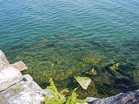
Colour • Transparency • Temperature • Pressure • Depth • Currents • Budget • Chemical Composition • Pollution • | |
| Recreational Areas | |
|
Circumbaikal Railway • Peschanaya Bays • Olkhon Island • Chivirkuysky Gulf • Wooden Irkutsk • Trans-Siberian Railway • | |
| People of Lake Baikal | |
|
People of Siberia • Buryat nation in Baikal • Russians in Baikal • | |
|
| |
| The face of Baikal - Water © A description of Baikal's water & questions concerning its pollution by S.A.Gurulev Currents of Lake Baikal Water
In Baikal there are two main kinds of current: permanent (geostrophic - from the Greek words geo - Earth, and strophe - a twist, turning about) and drift. Permanent currents are those that keep their main features over long periods. In Baikal's waters, these move, as a rule, anticlockwise. For this reason they are called cyclonical. In general it can be said that the whole of Baikal is caught up in currents of a cyclonical type. These currents are divided up into different fields apparently owing to the peculiarities of form of the Baikal basins. Speeds of the cyclonical currents measured at different places sometimes reach 18 - 20 centimetres per second [cm/s] and even 50 cm/s. However, countercurrents and churning are often observed here. So the total (vectorial) speed of the currents is not very great, up to 8 - 9 cm/s, and often lower than that, up to 4 - 6 cm/s. Cyclonical currents are characteristic not only of Baikal; they also occur in the Baltic, Barents and Aegean Seas and in lakes Ladoga and Huron. Significant distortions in Baikal's currents are brought about by winds. These cause strong but relatively short-lived drift currents. During a wind, lasting from a few hours to a few days, movement is caused in the surface layer of water, but this has its effect on the entire water mass right down to the deep water bottom layers. The strongest winds which cause these drift currents at Baikal are the mountain wind, the Kultuk, the Barguzin, Verkhovik and Shelonnik. The mountain wind (Gora, Gornaya, Gornyak, Sarma, Kharakhaikha) blows along the western shores of the lake, from the west and north west, and from the mountainous peaks of the Primorsky and Baikalsky ranges. The Sarma, in the Olkhon region, is particularly strong. Its gusts are so strong that they can lift roofs off houses, and turn boats and launches over. In these gusts the wind speed can reach 40 metres per second [m/s]. Waves whipped up by this wind can be as high as 2 - 3 metres and in the centre of the lake up to 5.5 metres. The Kultuk (nizovik) blows from the south-west along the entire length of the lake. The speed of this wind can get up to 18 - 20 metres a second. When this wind is blowing the whole lake is disturbed, the height of the waves usually being no less than two metres, and in the zone where the wind speed is highest can reach more than 3 metres. The waves caused by the Kultuk take a long time to settle in North Baikal, here waves of a swell of more than 2.5 metres rock this part of the lake. The Barguzin blows from the north-east down the valley of the Barguzin. Typically this is an autumn and winter wind. In the open sea, it reaches a speed of 18 - 20 metres a second. Storms brought about by the Barguzin whip up waves of 3.5 - 4 metres along the western coast of the lake in the region of Olkhon and Goloustnaya. The Verkhovik (Angara), a north and north-easterly wind, blows over the whole lake, usually in spring and summer. Its speed can reach 18 - 20 metres a second. The Shelonnik (Selenga) comes from the south-east. In the summer its speed is moderate, up to 10 metres a second, and stronger in autumn, up to 20 metres a second. It reaches its maximum speed at the mouth of the Selenga and quickly weakens in Baikal's southern basin. Only seldom does it raise storms in this southern part with waves of more than 2 metres. An important and interesting question is that of the deep circulation of Baikal's waters. The possibility of the deep circulation of waters for some reason always fascinates people, especially the local people. A lot of stories are told about this, from the most fantastic to the quite authentic. Long since amongst local people there has been the popular belief that Baikal is connected in its depths with the ocean. I heard one quite genuine story once from a foreman amongst Baikal fishermen. I have no doubt about the authenticity of what was told. On one occasion a team of fishermen put out some two kilometres of sea netting for the night in the open sea. And, as is usual practice, the fishermen tied the boats and karbass (a large goods boat) to the end of the nets and drifted together with them all night around the sea. The night was clear and starry, and Baikal calm and still. Early in the morning, the foreman, having woken up first, threw a glance at the whole long stretched out and curving snake-like line of upper net floats. Everything was all right. But in a short while, taking another look at the floats, the foreman noticed something wrong. At the far end one after another the floats were abruptly disappearing under the water and not returning. One after another, closer and closer to the boats and karbass. There was good reason to be dumbfounded. And so the last float disappeared under water. The rope connecting the net and the boats stretched taut, pulling the stern of the karbass down. At last, waking up to what was happening, the foremen cut through the rope in one stroke. The fishermen waited at this place for a long time, hoping that the nets would bob up, but they waited in vain. It is difficult to say what this was. A fish? A nerpa? But they float up when they get into the nets. There are no wales in Baikal. More likely than not one must suppose that this had been a vertical vortical stream taking the nets down into the deep. In the 1920s V.V.Shostakovich expressed the opinion that beneath the active top 200 metre layer there lies a mass of water that plays no part in the life of the lake. He wrote that in this body of water "complete calm and motionlessness reign". These views were refuted in the thirties by G.Y.Vereshagin who was studying the lake's thermal regime. He showed that during strong winds, especially from the north-west, relatively cold deep waters rise to the surface by leeward shores, coming, judging by their temperature, from depths of up to 600 metres. In the Barguzin Bay, Vereshagin noted a rising of deep waters near the Svyatoi Nos. These waters round the Svyatoi Nos peninsular from the south and move further on towards the Ushkanye Islands. In 1957, V.A.Tolmachev put forward his opinion on the formation of the chemical regime of deep waters under the influence of strong vertical circulation. Following Vereshagin he singled out three hydrochemical zones in the body of water: an upper dynamic zone having a high concentration of chemical substances and going down to 500 metres; a middle stagnant zone, where the component content is minimal, stretching from 500 to 1000 metres; and a deep water zone, below 1000 metres, in which the concentration of substances varies with time. The waters of the top and deep zones are involved in mixing, the mechanisms of which are unknown. Tolmachev made the suggestion that the surface waters mix with the deep waters by descending the underwater slopes assisted by the peculiarities of the relief. Since the 1970s the isotopes oxygen 018, deuterium, (an isotope of hydrogen with a mass of 2, in combination with oxygen forming "heavy water"), and tritium (an isotope of hydrogen with a mass of 3) have been used in investigations of the exchange between different waters and deep circulation in Baikal. The oxygen isotope and deuterium content in Baikal water is the same as it is in the waters of Siberian rivers. This prevents its being used as an indicator. It is another matter with tritium. This is a short-living isotope with a half life of some 12.5 years. In natural conditions it is formed in the upper layers of the atmosphere under the impact of cosmic particles (protons and neutrons) on the nuclei of nitrogen and oxygen. It enters the lake via the atmosphere with rain and river waters. Using this, it is possible to analyse water circulation. V.N.Soifer, V .S.Brezgunov, K.K.Votintsev, V.I.Verbolov, M.N.Shimaraev and others have carried out such research at Baikal. In a number of places a higher than usual concentration of tritium was found at different depths in the body of water. This made it possible to draw a conclusion about the deep circulation of waters, and about the transportation of tritium enriched river waters into deep water zones. The mechanisms of such mixing, however, was not clear. It was suggested that river water was transported into the deeps in compact streams. Data on the distribution of tritium in Baikal was also discussed by V.I.Ferronsky, V.A.Polyakov, V.V.Romanov and others. For example, it was shown that the ratio of tritium in the lake's waters to that coming via rivers and in atmospheric precipitation depends on the time of water exchange in the lake. The latter is calculated quite simply: the volume of water in the lake is divided by the quantity of water input (the "box" model). In Baikal's case it looks like this: 23000 cubic kilometres must be divided by 70.2 cubic kilometres, which comes to 330 years, that is the time it takes for the water in the lake to be renewed completely. Lake Issyk-Kul has the same time scale for water renewal. It turns out that Baikal and Issyk-Kul also have the same ratio of tritium in the lake waters to that in waters entering the lake, 0.31 : 1. On the other hand, according to the ratio of tritium in atmospheric precipitation and in the lake waters a larger value is obtained for the exchange of waters, that is, 370 years. But it should be lowered since Baikal is fed mainly by river waters (82% of all incoming waters). In other words, a complete renewal of Baikal's waters can take place over 330 years. As for deep water circulation, this is confirmed by the higher concentration of tritium (it is true, not always) in the bottom layers. This speaks in favour of one conclusion, that is, that the circulation of water happens quicker than the half-life of tritium, or less than 12.5 years. Recently, researchers have come to the conclusion that tritium enters the rivers and lake in atmospheric precipitation and that it has anthropogenic origins. V.S. Lapin and V.I.Lapkanov have determined that 160 grammes of tritium are contained in Baikal, 144 g. of which, i.e. 90%, is the product of nuclear explosions made in the atmosphere over the period 1956 - 1962. A decrease in the tritium content of Baikal's waters will take place over the next 50 years. Results have also been achieved in the study of the circulation by using coloured substances. In the autumn of 1984, K.A.Korotenko and A.L.Sukhov studied the currents and transportation of matter in Central Baikal using the point dye method. They pointed out that Central Baikal is notable for its intense mixing of water masses and complex current pattern. In one experiment off Cape Khoboi, at the northern end of the island of Olkhon, the quick descent of a coloured patch was observed which was accounted for by a current of warm waters here from the Maloye Morye and consequent sinking of cold waters of the open part of the lake. A systematic study of the temperature regime of deep waters is also being carried out. In 1984 M.M.Liubimtsev and A.L.Sukhov determined an anti-cyclonical deep water current along the south-eastern shore of South Baikal appearing beneath the temperature jump layer. On the surface here there is the usual circulation current, that is, the water moves in an anticlockwise direction, while at depth it moves in the opposite, clockwise, direction. K.K.Votintsev came to an interesting conclusion about the deep circulation of waters. He drew attention to the dissolved oxygen content in the waters. Baikal's waters are very oxygen rich. At the surface the oxygen content is near normal, and in summer the surface waters are even oversaturated in oxygen, that is, up to as much as 115 - 120% saturation. The oxygen content decreases with depth, but even in the deepest parts of the lake it is never below 75 - 70%. This incredible feature is found only in Baikal. In Lake Tanganyika, for example, even at a depth of 70 - 130 metres the water lacks oxygen, and at depths of 200 - 300 metres there is a constant hydrogen sulphide content. Oxygen enters the deep waters of Baikal only from the surface where its concentration is maintained by exchange with the atmosphere and photosynthesis. The oxygen content was analysed at different depths along a line from Listvyanka to Tankhoi. Down to a depth of 200 metres a springtime maximum and autumn minimum in the oxygen distribution is observed. Lower down (to 1400 metres) top maximums appear: a winter (December to February) and summer one (July - August). The 750 metre horizon is an exception, however, with one maximum occurring (from November to February). The pattern of oxygen distribution indicates its build up in the deep waters as a result of their constant mixing with surface waters. Such mixing is particularly strong in autumn, when storms rage at Baikal before the ice forms. Votintsev came to the conclusion that vertical mixing of the waters in Baikal takes place yearly. In 1991, R.F.Weiss (USA), E.C.Carmack (Canada) and V.M.Koropalov (Russia) published the results of a study of the temperature of the water mass of Baikal from the surface to the bottom, and the distribution of Freons, oxygen, phosphates, nitrates, and silica in the journal "Nature" (GB). The distribution of the Freon (CFC-12, difluorinechloromethane) is particularly interesting. The Freon, as is well known, is of purely anthropogenic origin. It is filling more and more the waters of the world's oceans, rivers and lakes, and eroding away the ozone layer in the planet's ionosphere, removing its defence against ultra-violet rays. Its distribution in Baikal's waters reflects the speed of exchange of surface and deep waters and enables us to determine their approximate age. The youngest - about one year - are the waters of the top 200 metre layer. The water 'ages' with depth and in the 800 to 1200 metre layers they are some 12 - 16 years old. At the very bottom, in the deepest parts, they are again younger (up to 8 - 9 years), which indicates the existence of mechanisms that take water from the surface layers to great depths directly. The distribution of the Freon in Baikal's water indicates, in the opinion of researchers, deep circulation of surface waters that renew the bottom layers of water. The exchange of waters of all layers below 200 metres takes 8 years. In 1993, M.N.Shimaraev, N.G.Granin and A.A Zhdanov (Russia) published the results of research into the temperature of the lake's water in June in the journal "Limnology and Oceanography" (USA): The waters of the open part of the lake remain relatively cold. It is the coastal waters that warm up. And convection is caused in these waters when the temperature threshold of +4°C, that is, when water is at its most dense, is reached. But this is still not deep water exchange. The gradual warming of the coastal waters brings about a so called 'thermobar', during which the compact part of the water body under the effect of compression move downwards and gradually reach the bottom. In this way the deep waters are diluted by the surface waters. The process of deep convection can occur all over the lake; it depends on the climate regulating it and on the temperature of the lake's waters. During the deep circulation of surface waters sudden vortical currents can arise, plunging down into the deeps, into Baikal's abyss. |